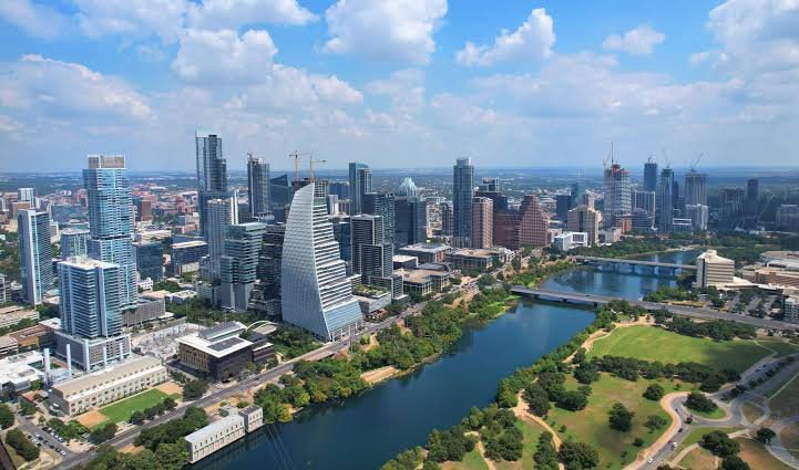
Planning drone photography in Austin starts with checking the airspace around the location. Controlled airspace around airports affects parts of Austin, and temporary restrictions can also affect flight plans. Understanding Federal Aviation Administration (FAA) requirements helps photographers select suitable locations, plan flight altitudes, arrange required authorizations, and schedule aerial photography efficiently.
What FAA Rules Apply to Commercial Drone Photography?
Commercial drone photography generally operates under FAA Part 107. These rules establish requirements for pilots and drones used for business purposes. Key requirements include:
- Remote Pilot Certification: The remote pilot in command must hold an FAA Remote Pilot Certificate.
- Drone Registration: Drones operated under Part 107 must meet applicable FAA registration and marking requirements.
- Flight Requirements: Pilots follow rules covering visual line of sight, altitude, operations over people, and moving vehicles.
These requirements provide a clear foundation for planning commercial drone shoots.
How Does Controlled Airspace Affect Your Austin Shoot?
Parts of Austin are within controlled airspace associated with airports, including Austin-Bergstrom International Airport. Part 107 pilots need FAA authorization to operate in Class B, C, or D airspace, or within the surface area of Class E airspace designated for an airport.
Authorization requirements and available altitudes depend on location. FAA UAS Facility Maps show grid altitudes that help pilots prepare authorization requests around airports. These maps support flight planning, while pilots receive authorization separately through the applicable FAA process.
How Does LAANC Help With Airspace Authorization?
The Low Altitude Authorization and Notification Capability (LAANC) allows eligible pilots to request access to participating controlled airspace through FAA-approved service suppliers. When submitting a request, pilots provide details such as location, altitude, date, and time.
Requests at or below applicable UAS Facility Map grid altitudes can receive near-real-time authorization. Part 107 pilots requesting higher altitudes, up to 400 feet above ground level, can use LAANC for further coordination for FAA review.
How Can Temporary Flight Restrictions Affect Your Shoot?
Temporary Flight Restrictions (TFRs) apply to designated airspace for specific periods. Pilots should check current FAA information for conditions such as:
- Major Sporting Events: Certain qualifying sporting events have flight restrictions around venues.
- Emergency Situations: Wildfires, disaster response, and other emergencies can lead to temporary airspace controls.
- Security Events: Certain VIP movements and national security activities can create temporary restrictions.
Checking current TFR and NOTAM information helps photographers plan flights around active restrictions.
Why Should Airspace Checks Happen Before Booking a Shoot?
Early airspace checks help establish suitable altitudes, authorization requirements, and scheduling options. Pilots can assess the location and allow time for required authorizations while coordinating the flight with the photography schedule.
For businesses arranging drone photography in Austin, this preparation supports efficient scheduling. A qualified Part 107 pilot can assess applicable airspace requirements and plan the aerial shoot around current operating conditions.
Conclusion
Austin drone photography requires attention to the airspace surrounding each shoot location. Part 107 rules, controlled airspace, LAANC authorizations, and temporary flight restrictions can shape flight plans. Reviewing current FAA information for the specific site helps photographers identify suitable altitudes, complete applicable authorization steps, and coordinate the shoot efficiently.